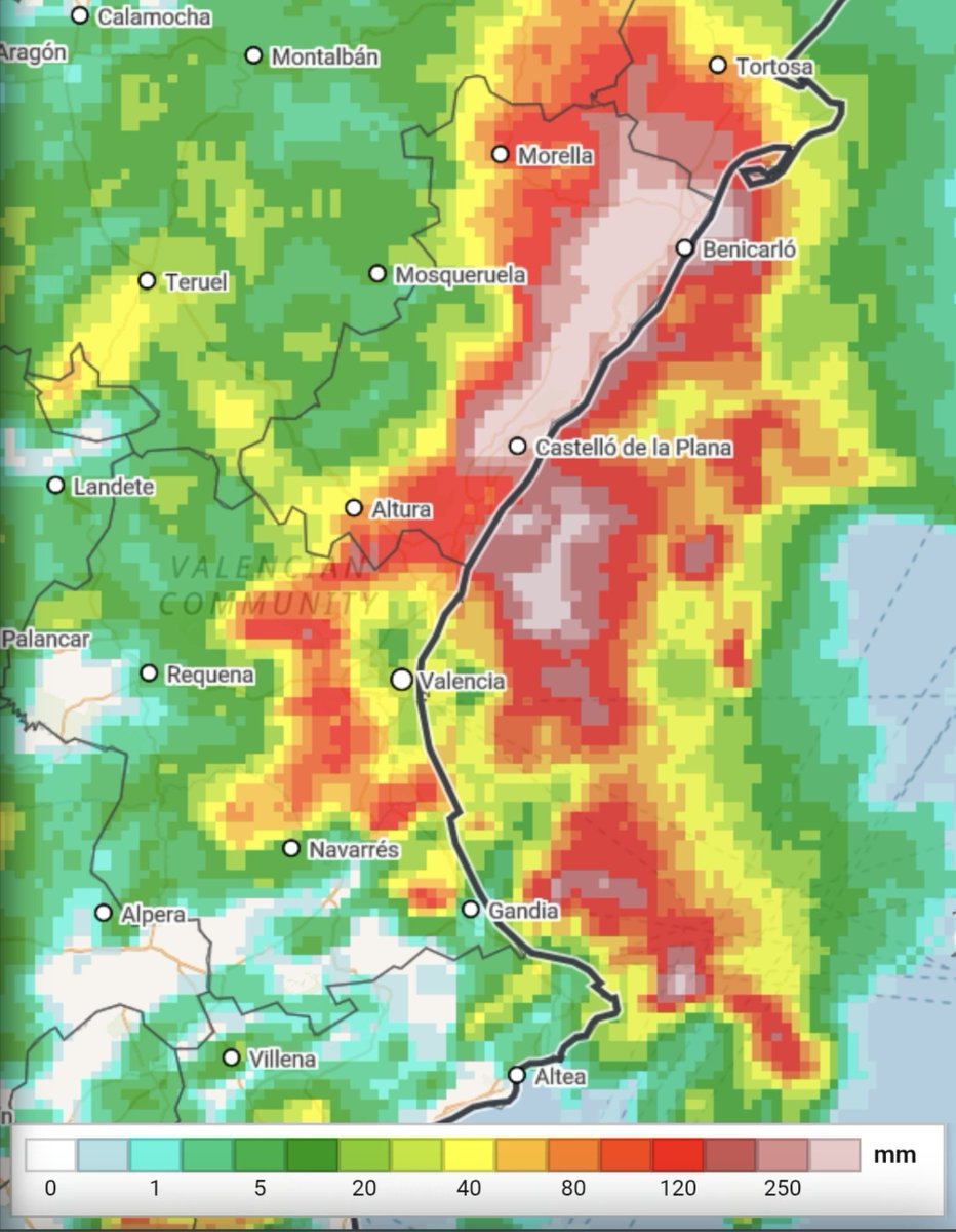
The usual critiques are already starting, so it's worthwhile to put on the table how meteorological science works in an episode like this. The numerical models showed a clear scenario of irregular but high-impact storms. In this configuration, the key is not that it rains everywhere equally, but the danger where storms form and barely move: torrential intensities (>90 mm/1h) and critical accumulations (>180 mm/12h). We don't work with a crystal ball; we work with supercomputers that solve millions of mathematical equations to project the future atmosphere. Why is it so complex to specify the exact municipality? Unlike a winter storm with continuous and organized fronts, the physics of these storms is much more complex. They depend on how winds collide on a microscale, humidity, and relief over just a few kilometers. They do not follow a rigid pattern: they move and regenerate where that flow collision occurs, and modeling that to the millimeter is a huge challenge. Science always has room for improvement, of course. But before blaming meteorologists and @AEMET_Esp, it's worth remembering the rigor and constant vigilance behind issuing warnings that save lives. (translated)