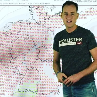
Diploma meteorologist Dominik Jung announced to BILD: "Colder air is streaming into Germany from the north." #Wintereinbruch #Schnee #Deutschland (translated)
This profile is not managed by Dominik Jung.
Wrld compiles it automatically from public sources:
Diploma meteorologist Dominik Jung announced to BILD: "Colder air is streaming into Germany from the north." #Wintereinbruch #Schnee #Deutschland (translated)
"With the cold front and the shifting wind to the northwest, significantly colder air is flowing into Germany, and the snow line is continuing to drop day by day. On Friday, it will initially be around 1000 to 1200 meters," says diploma meteorologist Dominik Jung to BILD. #Schnee #Kältewelle #Winter (translated)
Diploma meteorologist Dominik Jung to BILD: "A low pressure system is moving from Ireland towards northern France and is causing heavy rain, especially from the west to the middle of Germany." #Wetterbericht #Schneefall #Polarluft (translated)
Meteorologist Dominik Jung explains to BILD: "These extreme contrasts in a small area are, by the way, exactly the engine that drives the storm low." #Wetterwechsel #Schnee #Frost (translated)
Diploma Meteorologist Dominik Jung: "After the dry year, many trees are weakened, branches may break off more quickly than usual." Dominik Jung even considers up to 150 liters in total to be likely: "Small streams can swell rapidly, local flooding is possible." #Sturmwarnung #Unwetter #WetterDeutschland (translated)
Against BILD, diploma meteorologist Dominik Jung already announces: "The storm risk is clearly increasing!" #Sturmserie #Wetterbericht #Herbststurm (translated)
"Saturday is actually the calm before the storm," says diplomatic meteorologist Dominik Jung to BILD. #Herbststürme #WetterDeutschland #Sturmwarnung (translated)
"On Friday, Germany lies behind a cold front in polar maritime air. During the day, only 4 to 9 degrees will be reached, along with a fresh, gusty westerly wind, initially also stormy at the North Sea. It feels significantly colder than the thermometer indicates. There will also be occasional showers, with sleet in the north," says meteorologist Dominik Jung to BILD. Jung: "The nights will be quite frosty: The night from Friday to Saturday and especially the night from Saturday to Sunday will be the coldest in weeks under clear skies. Away from the coasts, temperatures will widely drop to 0 to minus 5 degrees." #Kältewelle #Wetterbericht #Frost (translated)
Diploma meteorologist Dominik Jung finds objective words for the classic November dreariness when speaking to BILD: "At the moment, we have an air mass boundary running across Germany. In the north and northeast, there is already cool polar air from Scandinavia, while the south was still mild and wet. The cold front is now pushing this boundary towards the Alps." #Kaltfront #Wintereinbruch #WetterDeutschland (translated)
Diploma meteorologist Dominik Jung also confirms to BILD: "On Wednesday, föhn will set in at the Alps, and in the southwest, the thermometer will even climb to up to 14 degrees." #ErsterSchnee #Wetterbericht #Deutschland (translated)
"The rain will first reach the Alpine region and the south on Monday, advancing by evening to a line from Saarland to Regensburg. On Tuesday, it will mainly rain in Baden-Württemberg and Bavaria," says diploma meteorologist Dominik Jung to BILD. #Dauerregen #WetterDeutschland #Herbstwetter (translated)
Against BILD, weather expert Dominik Jung announces for Monday: "In Saarland, in the Palatinate, and in Baden, after initial forecasts, 50 to 80 liters per square meter could fall within 48 hours. That would be as much as it normally rains in a very typical November." #Starkregen #Wetterprognose #November (translated)
Diploma meteorologist Dominik Jung: "On Friday, a hurricane low from the British Isles is heading towards Europe and Germany." #Herbststurm #WetterDeutschland #Sturmböen (translated)
"A cold front crossed the northwest on the night to Saturday and is moving further south. Behind it, significantly colder air from the north is pushing in. In the south, however, the front is making little progress and is stalling there. At the same time, a cut-off low pressure system is forming over France, which will send more rain clouds from the southwest to Germany starting Sunday. Along this air mass boundary, it will rain for many hours." #Kaltfront #Dauerregen #Herbstwetter (translated)
There is a temperature drop, in many regions it will be up to 8 degrees cooler, says Jung in response to a BILD inquiry. #Wetterwechsel #Temperatursturz #Herbstwetter (translated)
"I expect this to happen in mid-October, but a reliable snow cover will only come in November." According to meteorologist Dominik Jung, a significant cold front with moist air is needed to lower the snow line. #Matterhorn #klimaatverandering #Zwitserland (translated)
„Das Bild ist leider kein Fake, sondern das Ergebnis eines extremen Jahres in den Alpen. Wir haben dort einen Sommer hinter uns, der alles in den Schatten stellt“„Das Bild ist leider kein Fake, sondern das Ergebnis eines extremen Jahres in den Alpen. Wir haben dort einen Sommer hinter uns, der alles in den Schatten stellt“, erklärt Diplom-Meteorologe Dominik Jung von wetter.net gegenüber BILD. #Klimawandel #Matterhorn #Alpen
„Ein kräftiges Sturmtief bei Island lenkt auf seiner Vorderseite mit südwestlicher bis südlicher Strömung sehr warme Luft nach Mitteleuropa. Gleichzeitig sorgt ein Hochdruckkeil über Deutschland für viel Sonnenschein. Für Ende September ist das bemerkenswert.“Wetter-Experte Dominik Jung erklärt den heißen Föhn-Effekt: „Ein kräftiges Sturmtief bei Island lenkt auf seiner Vorderseite mit südwestlicher bis südlicher Strömung sehr warme Luft nach Mitteleuropa. Gleichzeitig sorgt ein Hochdruckkeil über Deutschland für viel Sonnenschein. Für Ende September ist das bemerkenswert.“ #HeißerHerbst #Hitzewelle #Wetterdeutschland
„Eine Kaltfront schwenkt von West nach Ost über Deutschland und räumt die heiße Luft nach und nach ab.“
Claim it. Contact us at [email protected]