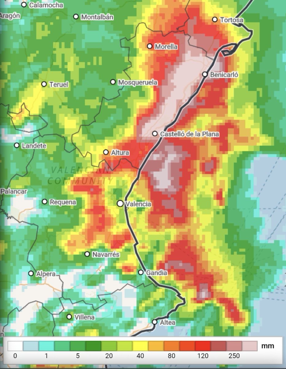
⚠️ATTENTION AFFECTED AREAS DANA 29-O⚠️ ➡️Although this situation is of high danger, it is not a scenario in any way similar to 29-O. The most intense rainfall will be in a much smaller area, closer to the coast and of shorter duration, thus reducing the risk of river and ravine overflow. 🚨The risk will be rainfall flooding (the drainage system is not capable of handling the rainwater) but maintaining the risk (with lower probability) of some local overflow, especially in the NORTH OF CASTELLÓN where the rainfall may be more intense inland. ⚠️Even so, we repeat that this is a situation of much uncertainty and difficult forecasting. There is a possibility that storms may occur at sea or with greater or lesser intensity than predicted. The red alert is CORRECT from AEMET. 📲🔴About the Es-Alert: it has been used to notify of the red alert that comes into effect from 18:00 and ends at 1:59 on Friday. In this tweet, we will not comment on its use; we will leave that for after the episode. 🗺Map: Accumulated precipitation in 12h https://t.co/A6YUIBXlF2 https://t.co/A6YUIBXlF2 #Dana29O #Inundaciones #Clima (translated)