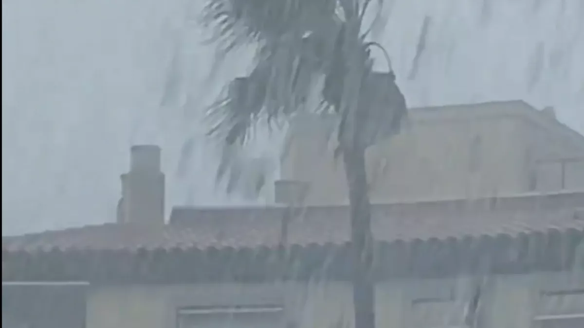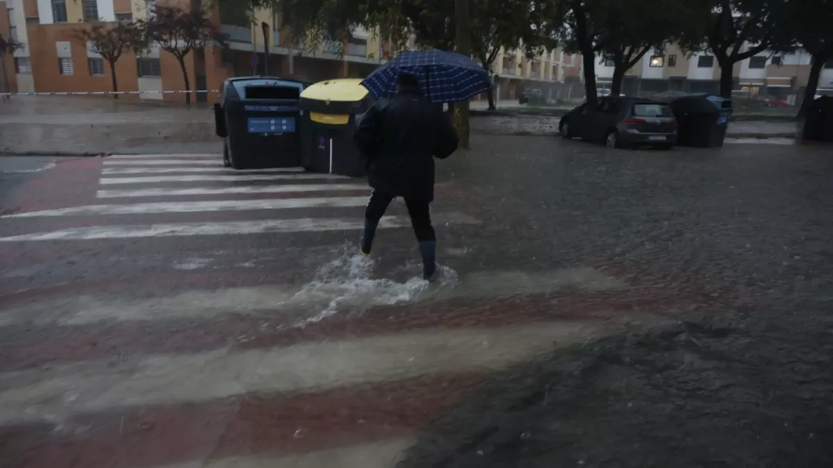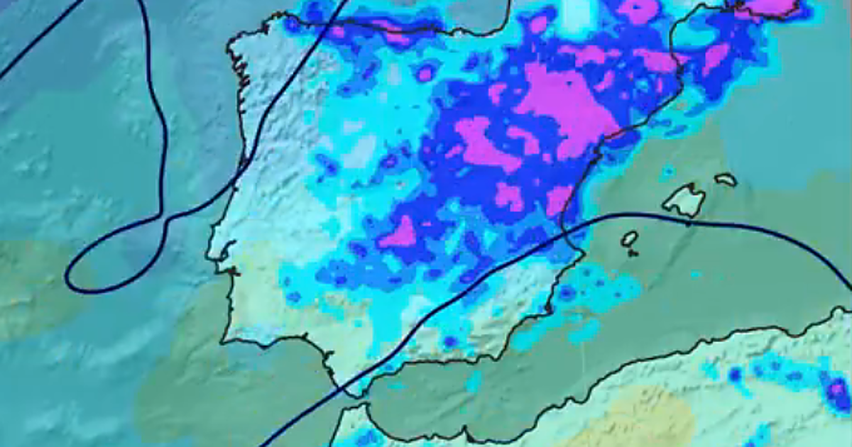
A heavy rainstorm and hail in Arcos de la Frontera have caused flooding in streets and homes, damage to vehicles, and wall collapses, without any reported injuries. #ArcosdelaFrontera #TrombaDeAgua #DANAAdam (translated)
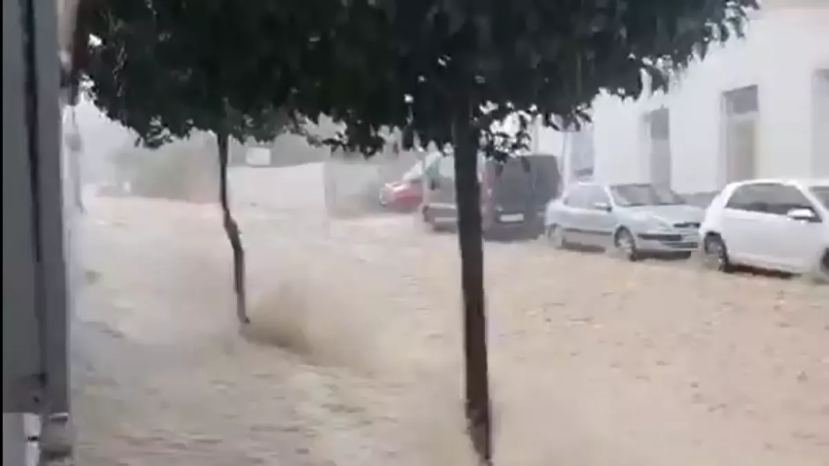
A heavy rainstorm and hail in Arcos de la Frontera have caused flooding in streets and homes, damage to vehicles, and wall collapses, without any reported injuries. #ArcosdelaFrontera #TrombaDeAgua #DANAAdam (translated)

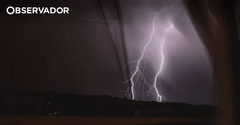
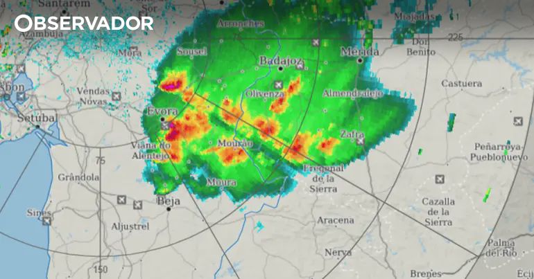
The districts of Faro and Beja are under a yellow warning, valid between 12:00 PM and 6:00 PM this Monday, due to the forecast of thunderstorms, heavy rains, hail, and gusts of wind, as reported by the Portuguese Institute of Sea and Atmosphere (IPMA). #Meteorologia #Trovoadas #AlertaAmarelo (translated)

Professor Eduardo (The Weatherman) warned of a period of instability between this Monday and Friday in Norte Chico, the central area, and part of southern Chile, up to Los Lagos. According to what he wrote, heavy rains, thunderstorms, hail, and moderate winds were expected, with the most storm activity forecasted for Tuesday, Wednesday, and Thursday. The author noted that the risk of sudden floods would be very high and that there was also a high possibility of mudslides, as the isotherm would be located between 2500 and 3000 meters above sea level, and could even rise further. He added that the system could cause more damage and complications than previous events. Regarding precipitation, he indicated that some areas could accumulate 20-45 mm and others could exceed 70-90 mm. He identified the interior between the Metropolitan and Biobío regions as the stretch with the highest likelihood of significant amounts, with places potentially exceeding 100 mm and registering periods of more than 10 mm per hour during the storms. He characterized the event as extreme for October and called for preparedness. #InestabilidadClimática #RiesgoDeInundaciones #TormentasSeveras (translated)
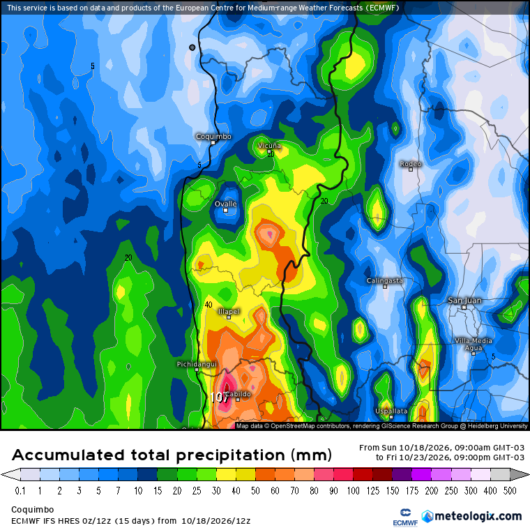
Professor Eduardo (The Weatherman) warned that a period of intense instability, which he said would last from Monday to Friday, would affect the region from Coquimbo to Los Lagos. He pointed out that a low-pressure system could cause rain of varying intensity, strong thunderstorms, hail, and wind; he also mentioned possible precipitation in parts of Atacama and strong winds in the northern region. Describing a projection from the European model ECMWF on Wibdy, he indicated that between Tuesday and Wednesday some areas could receive more than 20 millimeters of rain and others more than 50. He added that for Thursday and Friday, another round of precipitation and storms was expected, with cores that, as he explained, pointed to the potential for severe storms and hail. Eduardo stated that the number of storms posed a very high risk of sudden flooding and a high likelihood of landslides, due to the isotherm being situated between 2,500 and 3,000 meters above sea level, or even a bit higher. He warned that the episode could cause more complications and damage than recent events and that it could still intensify, so he urged people to prepare. #Inestabilidad #Tormentas #Clima (translated)
Professor Eduardo (The Weatherman) warned about a low-pressure system that, as he projected, would affect areas between Coquimbo and Los Lagos from Monday to Thursday, with variable intensity precipitation, thunderstorms, hail, and wind. He said there would be breaks with sun and clouds and that the rainfall would be uneven, with greater accumulations in inland and mountainous areas. The author warned of possible intense storms and downpours in the central region and noted that he could not specify where they would occur because, as he wrote, there were no radars. He also indicated that the risk of flash floods would be very high, especially on Tuesday and Wednesday, and that there was a high possibility of landslides due to the isotherm being positioned between 2,500 and 3,000 meters above sea level, or even higher. He estimated that accumulations could vary between 20 and 40 millimeters in some areas and exceed 70 to 90 millimeters in others, mainly between Coquimbo and Biobío. He added that the system could cause more damage and complications than recent events, that it could intensify, and that it would not be the last episode of the month. He announced a new update for the following day. #Clima #Tormentas #Inestabilidad (translated)
Professor Eduardo, known as The Weatherman, reported that he was closely monitoring an event with the potential for severe storms and a high risk of flooding in Northern Chico and the central area of Chile. According to what he wrote, a low pressure system would be stationary in front of the center of the country between Monday and Thursday of next week, favoring a prolonged period of instability, with precipitation, wind, possible thunderstorms, and hail between Coquimbo and Los Ríos. He indicated that the rains would be intermittent, with pauses and episodes of intense precipitation and storms. He also noted that the isotherm would be around 2500-2900 meters above sea level and that the accumulated amounts would average 20-40 mm. In interior areas between Coquimbo and Ñuble, he added, storms could leave more than 50-70 mm in less than 6 hours. He said he would update the information. #ClimaChile #Tormentas #Aluviones (translated)
Gustavo Petro wrote that he arrived in the midst of hail and toured the square, where he felt the solidarity support of thousands of people. He also expressed his hope that "the parade" would overcome fear. https://t.co/vTkN7UgPGj #Solidaridad #Valentía #Movilización (translated)
Open on X
Gustavo Bolívar described it as a rudeness that police armed with rifles intimidated, as he wrote, a joyful and peaceful march. He said that its participants firmly defended life and democracy, and that not even the rain with hail had managed to disperse them. https://t.co/TP5pZEfKGZ #DerechosHumanos #Democracia #Paz (translated)
Professor Eduardo (The Weatherman) indicated that a powerful cloud was advancing towards Talca and warned that heavy rains could return, along with thunderstorms and hail. https://t.co/8jDeEZjg6y #Talca #Clima #Tormentas (translated)
Open on X
Professor Eduardo reported that the intense thunderstorm started in Talca after 15:20 and shared a recording from his camera. He also described a large amount of rain and hail. https://t.co/A5nqGFKeGy #Tormenta #Talca #Clima (translated)
Open on XA nearly stationary cold drop caused intense thunderstorms, hail, and a 100 km band of rain in Alentejo between October 2 and 6, according to the IPMA. #Meteorologia #GotaFria #ChuvaIntensa (translated)

Eduardo, known as The Weatherman, indicated in his morning report that the instability of the front system would begin to develop in the coming hours. He noted that strong downpours, thunderstorms, hail, and wind were expected in the interior sectors of the central and southern areas by the afternoon, as well as a probable development of tornadic clouds between Maule and Los Lagos. He also asked his followers to comment on the situation in their areas. #Clima #Tormenta #Pronóstico (translated)
The author urged to take extreme precautions in Baix Camp, Baix Ebre, Ribera d'Ebre, and Terra Alta due to intense rainfall, significant hail, and very strong wind gusts. He also noted that the storms had intensified again and mentioned the high temperature of the Mediterranean Sea and a significant influx. (translated)
Thirteen districts of the Portuguese mainland are under yellow alert due to the forecast of thunderstorms, hail, and gusts of wind, according to the Portuguese Institute of Sea and Atmosphere (IPMA). #AvisoAmarelo #Trovoada #Meteorologia (translated)

Aemet forecasts intense rains this week across Spain, activating alerts in nine communities, especially in Catalonia, where warnings are issued about the possibility of storms and hail. #Lluvias #AEMET #Clima (translated)

The author warned that, in addition to rain, storms were expected on the coast of Barcelona, the southern coast of Girona, and the Ampurdán, with the possibility of hail and gusts of wind between 90 and 120 km/h. #Tormentas #Clima #Barcelona #ES (translated)
Open on XThe storm affecting the Mediterranean is causing heavy rains, hail, and flooded streets in several provinces of Spain, with accumulations exceeding 150 liters per square meter and alerts for flooding and flash floods. #TemporalMediterráneo #LluviasTorrenciales #Granizo (translated)

The Valencian Community has been declared on red alert due to the forecast of heavy rains, hail, and strong winds, which has led to the suspension of classes in several municipalities and the activation of emergency protocols. #AlertaRoja #LluviasIntensas #ComunitatValenciana (translated)

Aemet has issued a special warning for Madrid due to the arrival of a rain front that will bring heavy storms and hail, with accumulations of up to 50 liters per square meter until Sunday. #Madrid #Aemet #Tormentas (translated)

La Aemet prevé un drástico cambio meteorológico en España, con una caída de 10 grados en las temperaturas, tormentas con granizo y fuertes vientos que comenzarán esta semana. #CambioClimático #Tormentas #AEMET