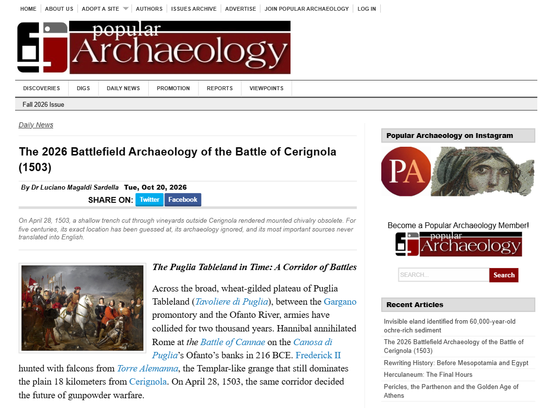
THE “BATTLE OF CERIGNOLA (1503)” ON “POPULAR ARCHAEOLOGY USA” (by LUCIANO MAGALDI SARDELLA) SOURCE 1: https://popular-archaeology.com/author/sardella/ SOURCE 2: https://popular-archaeology.com/article/the-2026-battlefield-archaeology-of-the-battle-of-cerignola-1503/ __________________________________________________________________ CERIGNOLA (FG) — On 28 April 1503, at sunset, a shallow trench cut through the vineyards outside Cerignola rendered heavy cavalry obsolete. For five centuries its exact position has been merely conjectured, its archaeology ignored, its most important sources never translated into English. We are on the Puglian Tablelanda, a corridor of battles for two thousand years: from Cannae in 216 BC to Frederick II’s falconry from Torre Alemanna. Cerignola, at that time, was not a town but a rural hamlet of 350 families at 120 metres above sea level, guardian of the Mena of the Dogana delle Pecore, the great customs system of transhumance that financed the Kingdom of Naples. It was for its possession that the battle was fought. Opposed, two worlds. Louis d’Armagnac, Duke of Nemours, Viceroy of Naples for Louis XII, thirty years old, splendidly armed, certain of victory. On the other side, Gonzalo Fernández de Córdoba, the Great Captain, who on 27–28 April marches from Barletta with some 9,000 exhausted men and decides to entrench himself upon a low ridge. In front of it he has deepened what was already there: not an invention, but an agrarian ditch. The French gendarmes, the last heirs of the mediaeval knight, lower their lances and never reach the line. From behind an embankment reinforced with vine stakes, more than 1,000 Spanish arquebusiers open fire. Nemours falls, almost certainly the first European army commander to die by a portable firearm. With him dies the cavalry charge as a dominant tactic. And here lies the scandal denounced by the article: no cartographer of the seventeenth or eighteenth century ever mapped the field. No memorial stone recalls it. It is not protected as a cultural landscape under the Code of Cultural Heritage. Every deep ploughing of the Tavoliere, standard practice since the Bourbon reforms, destroys an archaeology never recorded. Yet the perimeter is reconstructable. By cross-referencing sixteenth-century descriptions of “slopes covered with vineyards fifteen miles north of the Ofanto” with the Via Traiana, the engagement zone is a rectangle of 3–4 sq km to the north-east of the present settlement. With ISPRA’s 1m DTM LiDAR, anomalous linear depressions could be revealed, and the lower fill of a 2–3 metre ditch, beneath the ploughed layer, is still legible by magnetometry and ground-penetrating radar. Why have we arrived so late? Not for lack of sources, but for lack of translation. The Comune di Cerignola and the Centro Studi e Ricerche Torre Alemanna of Prof. Matteo Stuppiello, who in 1978 obtained the first monumental protection for Torre Alemanna, have digitised a corpus that has never entered Anglophone historiography. Here are the 3 pillars: 1. The letter that still smells of powder. The “Letter of Consalvo da Cordova to the Sovereigns of Spain of 29 April 1503,” edited by Stuppiello in 2003 and updated in 2025 on comune.cerignola.fg.it/biblioteche-digitali. A manuscript page written at Cerignola the day after the battle, “rich in flashes, twilight gleams, and gunfire.” Not a polished chronicle à la Giovio, but a field dispatch: the exhaustion of the night march, the decision to entrench upon arrival, the recovery and honourable burial of Nemours, the intact capture of the French artillery. 2. The graffito, a monument within the monument. In the fourteenth-century church of Santa Maria delle Grazie, known as the Incoronatella, on the Via Trinitapoli Vecchia, where tradition holds the body of Nemours was taken. On the triumphal arch, a graffito of 1503 gives in quasi-notarial form the date, sixth indiction, Friday at the twenty-third to twenty-fourth hour. It truly was a Friday, as confirmed by Cappelli’s perpetual calendar. Deciphered in 1995 by Prof. Francesco Magistrale, Latin palaeographer at the University of Bari, in La Battaglia di Cerignola (1993) and in the municipal monograph S.M. delle Grazie (1999). It is now fading through damp and neglect. 3. The cadastre that explains the ditch. The Apprezzo of 1672 preserved in the Archivio di Stato di Napoli, fondo Pignatelli Aragona Cortes, Scanzia 63, fasc.1: “At the time of the battle, dense vineyards covered the hill reaching down to the plain, and were clearly separated from the rest of the countryside by a not very deep ditch”. Córdoba did not improvise; he adapted. This is confirmed by the Giustiniani cadastres: 277 hearths in 1532, 699 in 1595. The landscape of 1503 was one of intensive horticulture, not the deep-ploughed cereal monoculture of today. To these are added the first monograph by Vincenzo Buonassisi, La Battaglia di Cerignola (1908, died at Via Fanfulla 10 on 27 June 1928), and the first modern military analysis by Piero Pieri, “Consalvo di Cordova e la battaglia di Cerignola”, Archivio Storico Pugliese 1952, which 30 years before the Anglophone rediscovery of “pike-and-shot” defined Cerignola as an engineered killing ground. While Cerignola forgot, others remembered. The “Regimiento de Infantería Cerinola n.42”, later “Fuerteventura n.56”, bore the name of Cerignola until the twentieth century. Its coat of arms, described in Heráldica e Historiales del Ejército, Tomo V (Madrid, 1981): argent field, a dying white swan entangled in a hedge, a gold mural crown, with scroll “Cerignola”. Dossier officially transmitted on 30 April 1986, prot. 4565/509, by the Servicio Histórico Militar in Madrid to the Centro Torre Alemanna through Col. Alessio Antonutti and Gen. José Cifuentes. And in Amsterdam, in the Rijksmuseum, the anonymous commemorative bronze medal: Hercules with lion-skin and club and Janus with keys beside an eagled coat of arms, legend “Consalvus Agidarius… Janum clausit”, on the reverse a battle scene “Consalvi Agidari Victoria de Gallis ad Cannas” — an error by the artist who confuses Cerignola with Cannae. It belonged to Mrs J.M. van Gelder-Nijhoff, donated in 1885. The author’s conclusion is unequivocal: Gonzalo’s ditch is the most consequential earthwork in European military history. It inaugurates the infantryman armed with a firearm and conditions the Mediterranean for 160 years. It may still be there, infilled, ploughed over, invisible to the naked eye but accessible to a magnetometer. It is not a question of mediaeval archaeology but of the will to protect.